Archived Satellite Photos Brought to Life by Modern Technology
Globally, more than 12,000 tailings facilities exist, many without survey records from construction or deposition.
By applying deep learning technology to archived satellite photos, PhotoSat has produced an engineering-quality survey record for a tailings facility, from the mid-1960s to the present day.
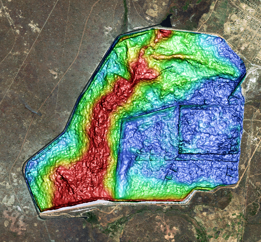
The Mopani Mine is an open-pit and underground copper mine located 6 km east of Mufulira, Zambia. It has been operational since 1933. A catastrophic tailings dam failure occurred at the mine in 1970, killing 89 miners. The mine added a new tailings storage facility (TSF) at the site's southern end. It became active in 1986,
with continued tailings deposition until the present day.
In this tailing history case study, PhotoSat created a full survey record of the TSF construction and deposition for the southern TSF for every year throughout its operational life. This created topographic data for the embankment structure, tailing's beach and supernatant pond on an iterative basis.
The study illustrates the potential for this type of survey record in proactive TSF management, and it's completed without site involvement or access.
PhotoSat searched commercial and declassified US Military satellite archives to produce this study, and this search yielded 315 photos taken between 1967 and the present day.
For more details, complete the form to download the full report.